Measuring Misti

Measuring Misti

Dominating the skyline of Arequipa, El Misti is a big volcano. Although slightly smaller than Sabancaya in absolute terms (i.e. height above sea level, 5822 m compared to 5976 m), the lower surrounding terrain of El Misti makes it look a lot more formidable. Indeed, our Peruvian colleagues at OVI warned us (repeatedly!) that El Misti was the harder of the two to climb. Having only just made it to the top of Sabancaya without losing our breakfast, it would be a lie to say that we were thrilled at the prospect of attempting something even harder. In the end, it was Yves and Nial who took up the challenge, and began stuffing camping gear into rucksacks

A day off?

After the exhausting ascent of Sabancaya, a day of rest was called for, and what better way to spend a day of rest than by carrying on working. Still based in Chivay (and still with our INGV and OVI colleagues) the team decided to head to the nearby Hualca Hualca volcano to investigate some fumeroles on its lower flanks. 

Friends of Trail By Fire: Peruvians, Sicilians, Volcán Ubinas, and Soft Cheese

Friends of Trail By Fire: Peruvians, Sicilians, Volcán Ubinas, and Soft Cheese

Riding the Guallatiri high, we headed for Peru. We had aimed to be on Peruvian soil by noon, but it wasn’t long until Yves’ “facilitating” skills were put to the test. In fact, we were turned away once, and made a second attempt after diplomatic assistance from the incredible people at IRD. On the second try, border patrol scrutinized every nut and bolt in our load, with rules seeming to change by the minute. But after 6 hours and cobbling together some pesos from among the seats of the Land Rover, the team were in Peru!

Trail By Fire Takes it Higher

After the hydrothermal loop, we felt ready to push higher onto the active volcanoes of the Andes. No better place to start than at the mighty Volcán Guallatiri, a 6100 metre high, actively degassing behemoth on the Chile-Bolivia border. Recently, this monstrous volcano gained fame by leaving the Top Gear trio and their 4x4s gasping for breath in the thin atmosphere at high elevation. All of The Trail By Fire team members were certain we could do better.

We took all precautions, considering that none of us (not even the Land Rover) had ever been so high. By carefully charting the elevation profile of the route in advance, we could monitor our health (e.g., heart rates) and the Land Rover’s performance, leaving opportunity for safe descent if the mission had to be aborted. The elevation profile from sea level at Arica could only be described as… “up”.

Profile of the route to Guallatiri.

Profile of the route to Guallatiri.

It quickly emerged that the ambitious route was no match for the Trail By Fire. We cruised through breathtaking vistas of the Parinacota region, fields of friendly alpacas and vicunias, and saline lakes with pink flamingos. Through it all, we adjusted well to the nuances of high-mountain commercial traffic on the Chilean-Bolivian route.

On the way to Guallatiri we encountered a 7km queue of trucks headed to Bolivia. We dealt with it the Chilean way.

The Land Rover, fully loaded, easily shattered its design maximum altitude of 4500 metres. We ran out of navigable (off) road long before we ran out of power, and parked up comfortably at a plateau between snow-capped Parinacota and Guallatiri volcanoes, at about 5300 metres above the Pacific Ocean we had swam in only that morning.

Guallatiri’s last major eruption was in 1960, with another “probable” one (unconfirmed due to its remoteness) in 1985. In June-July 2015, the Chilean authorities (SERNAGEOMIN) briefly put Guallatiri on alert due to elevated seismic activity. The weather was perfect. A short ascent on foot provided a good vantage point on the active plume, and we engaged part of our “mobile volcano observatory" to make remote measurements of SO2 flux by UV Camera and DOAS. The UV Camera in particular performed spectacularly, yielding robust data for calculating volatile flux from this remote volcano.

UV Camera images showing Guallatiri's SO2 emissions.

With data now starting to roll in, and with the Land Rover and our bodies now tested to extreme altitudes, we are ready for the next step -  crossing the border into Peru to embark on the most active and challenging leg of the Trail By Fire!

Trail by Fire selected for bursary

On March 5th, 2015, we were granted the means to achieve our ambitious scientific expedition. We're delighted to announce that the Royal Geographical Society with the Institute of British Geographers selected us as the team for this year's Land Rover Bursary.

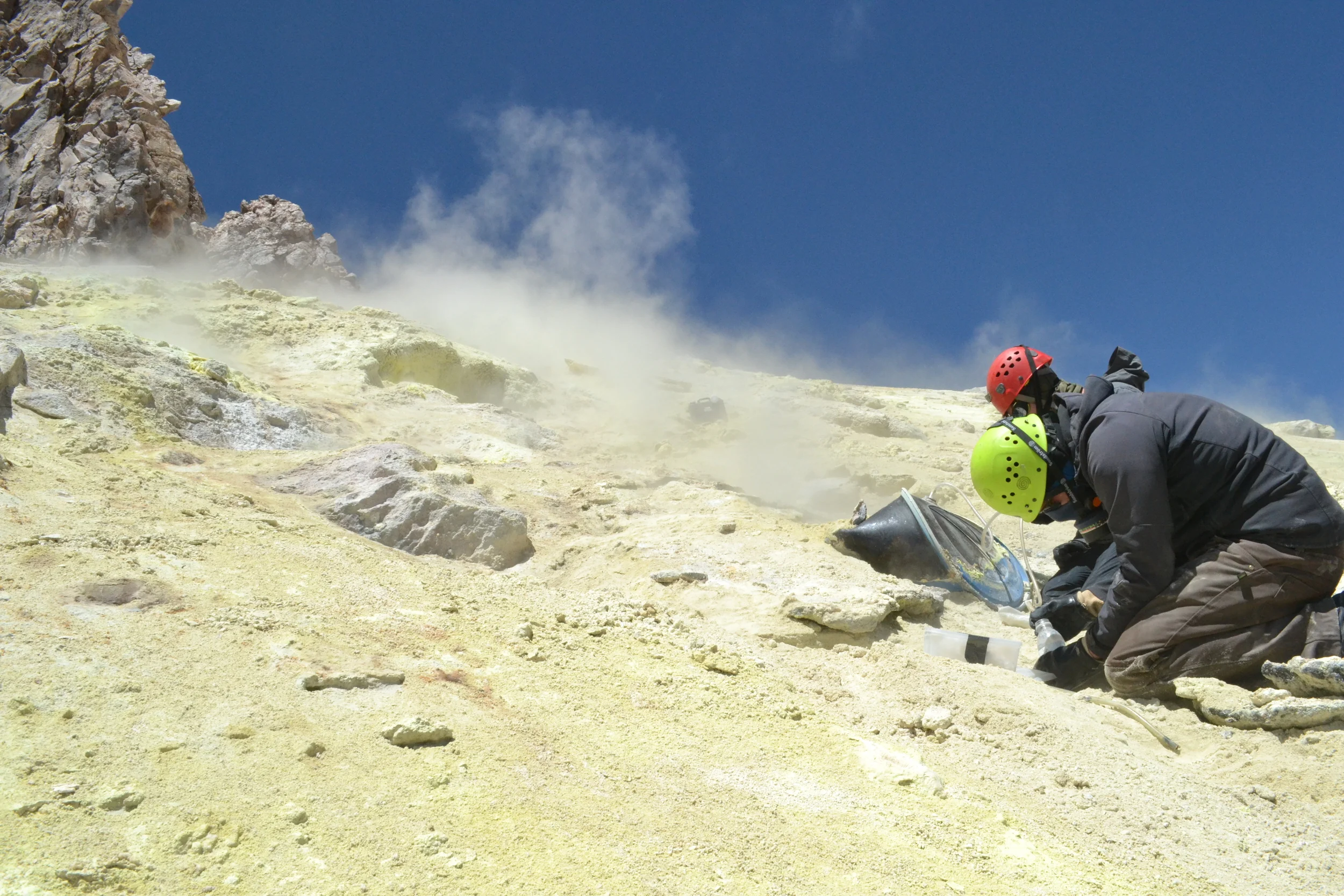
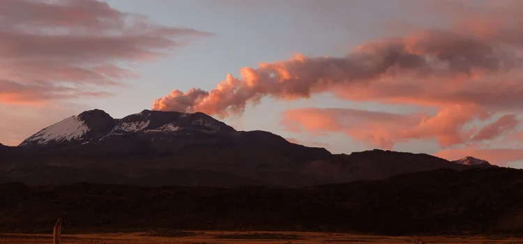
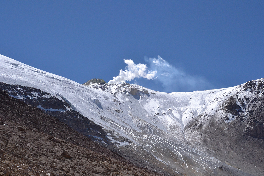
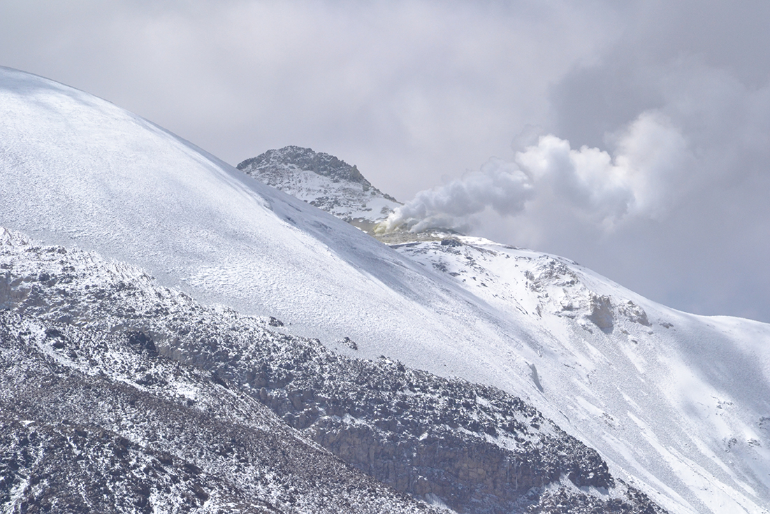
Every member of our team has studied erupting volcanoes around the world, from Erebus to Japan, but we've never had an opportunity like this before. In fact, no one has; our systematic study of volcanic emissions and ejecta along the length of the entire continent will be the first of its kind. We expect to publish ground-breaking science regarding continental-scale trends in volcanic behavior resulting from subduction. We'll be cruising along above the subducting Antarctic and Nazca plates, observing the gasses and clues they send our way to answer open scientific questions about what's going on deep beneath our feet, and the past, present, and future effect of those processes on our planet.

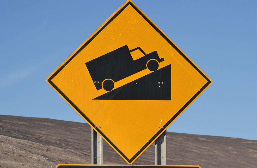
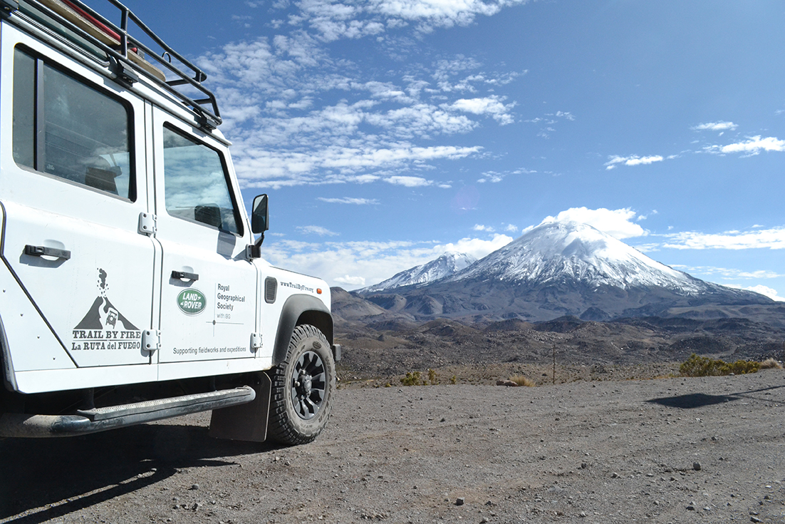
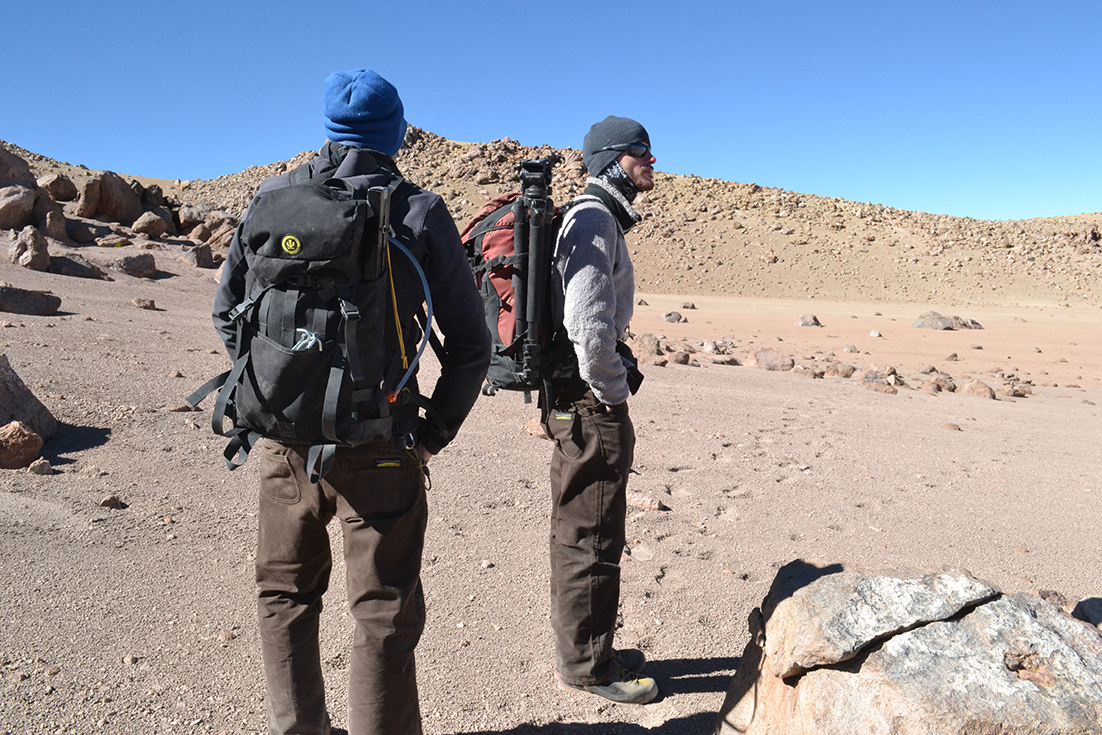
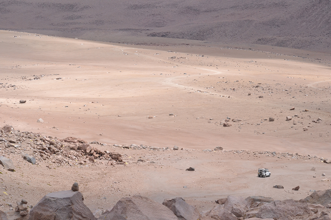
We've all worked on erupting volcanoes in Chile and Ecuador in the past, and found our work limited by inadequate vehicles. Imagine what it's like driving washed-out, ash-covered dirt roads up a mountain in an overloaded rental coupe. Not this time! Land Rover is providing us with ideal wheels. In a Defender we'll be able to travel in confidence. Our vehicle will also serve as an airbase for our flying robots, and a laboratory complete with state of the art spectrometers and cameras trained on volcanic plumes.

Trail by Fire is thrilled that our dreams are coming true, and we can't wait to share our work with you.